
GMDSS sea areas serve two purposes: to describe areas where GMDSS services are available, and to define what GMDSS ships must carry. Prior to the GMDSS, the number and type of radio safety equipment ships had to carry depended upon its tonnage. With GMDSS, the number and type of radio safety equipment ships have to carry depend upon the areas in which they travel. GMDSS sea areas are defined by governments.
In addition to equipment listed below, all GMDSS-regulated ships must carry a satellite EPIRB, a NAVTEX receiver (if they travel in any areas served by NAVTEX), an Inmarsat-C SafetyNET receiver (if they travel in any areas not served by NAVTEX), a DSC-equipped VHF radiotelephone, two or more VHF handhelds, and a search and rescue radar transponder. (SART)
Sea Area A1
An area within the radiotelephone coverage of at least one VHF coast station in which continuous digital selective calling (ch70) alerting and radiotelephony services are available, as defined by the International Maritime Organization.
The United States now has Sea Area A1 service as shown in Rescue 21 Distress System Coverage.
On 20 January 2015 the Coast Guard declared Sea Area A1 in certain areas off the coast of the United States based upon the performance of the Coast Guard's Rescue 21 System in accordance with applicable provisions of the International Convention for the Safety of Life at Sea, 1974 (SOLAS). The Coast Guard defines Sea Area A1 as those areas where more than ninety percent of the area within 20 nautical miles seaward of the territorial baseline along the East, West and Gulf Coasts of the United States, excluding Alaska, and including Hawaii, Puerto Rico, Guam, the Virgin Islands of the United States and the Northern Mariana Islands of Saipan, Tinian and Rota, is within coverage of Coast Guard very high frequency, or VHF Coast Stations that provide both a continuous watch for Digital Selective Calling, or DSC, distress alerts on Channel 70 and a capability to respond to distress alerts.
Sea Area A2
An area, excluding Sea Area Al, within the radiotelephone coverage of at least one MF coast station in which continuous DSC (2187.5 kHz) alerting and radiotelephony services are available, as defined by the International Maritime Organization. GMDSS-regulated ships travelling this area must carry a DSC-equipped MF radiotelephone in addition to equipment required for Sea Area A1.
The United States has no Sea Area A2 service. The US Coast Guard 2 MHz infrastructure is closed effective 1 August 2013.
Sea Area A3
An area, excluding sea areas Al and A2, within the coverage of an IMO recognized mobile satellite service in which continuous alerting is available. IMO recognized mobile satellite services currently (2023) include Inmarsat-C and Iridium LT-3100S systems. Ships traveling in this area must carry either an Inmarsat-C or an Iridium LT-3100S ship earth station, or a DSC-equipped HF radiotelephone, in addition to equipment required for an A1 and A2 Area.
Sea Area A3 is defined as the coverage of the IMO-recognized mobile satellite service that the ship is actually carrying, so it would be different for different ships. Recognized satellite services are required to declare their service area, and make that information is made available to its customers. Iridium service area is global. Inmarsat-C service area is shown below.
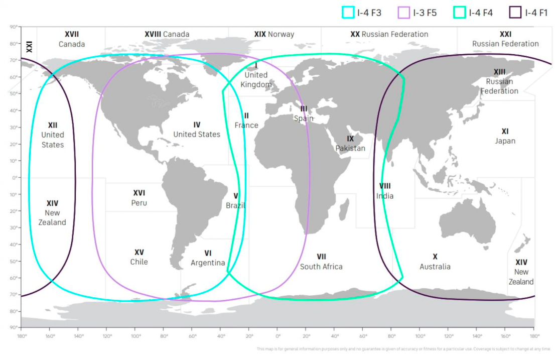
Inmarsat-C GMDSS Sea Area A3
Sea Area A4
The area outside that covered by areas A1, A2 and A3 is called Sea Area A4 Area. Ships traveling these regions must carry a DSC-equipped HF radiotelephone, in addition to equipment required for areas A1 and A2. Note that a ship carrying a ship earth station using an IMO recognized mobile satellite service with global coverage will not have a Sea Area A4. Sea Area A4 for purely geostationary satellite systems will be the polar regions. In the future, if a satellite system with limited regional coverage is recognized by IMO, Sea Area A4 could be a much larger area.
GMDSS Radio Equipment Required for U.S. Coastal Voyages
GMDSS-mandated ships operating off the U.S. coast must fit to Sea Areas A3 (or A4) unless they remain restricted to within Rescue 21 VHF range of shore. Radio communications equipment onboard such ships must be fitted to Sea Area A1 regardless of where they operate.
Search and Rescue Areas
These show the nation or rescue coordination center responsible for coordinating distress emergencies which occur in these areas. Search and rescue areas are still undefined in many ocean regions.
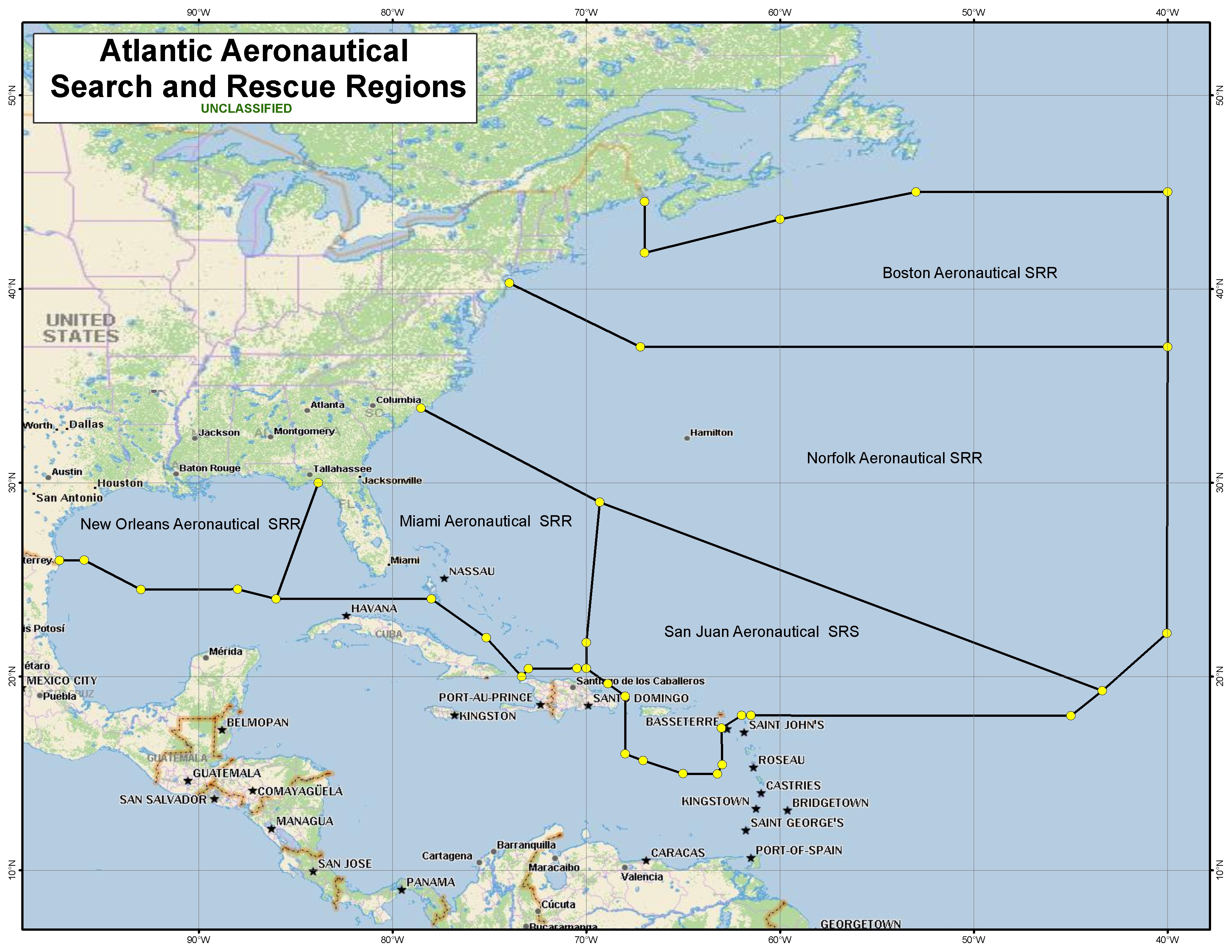
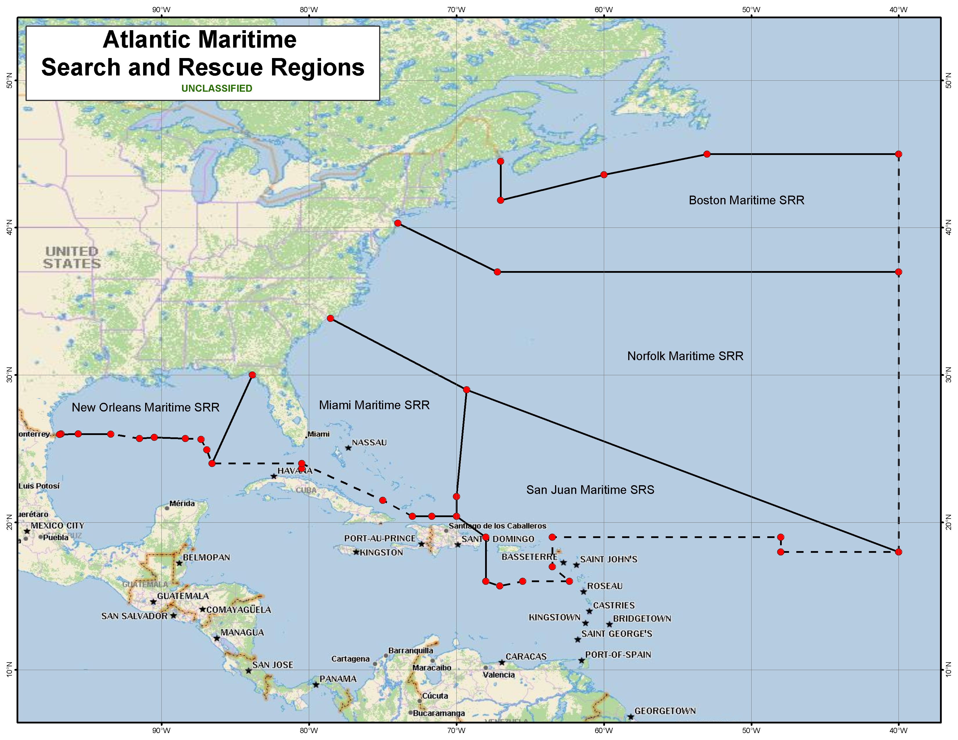
Atlantic Search and Rescue Area
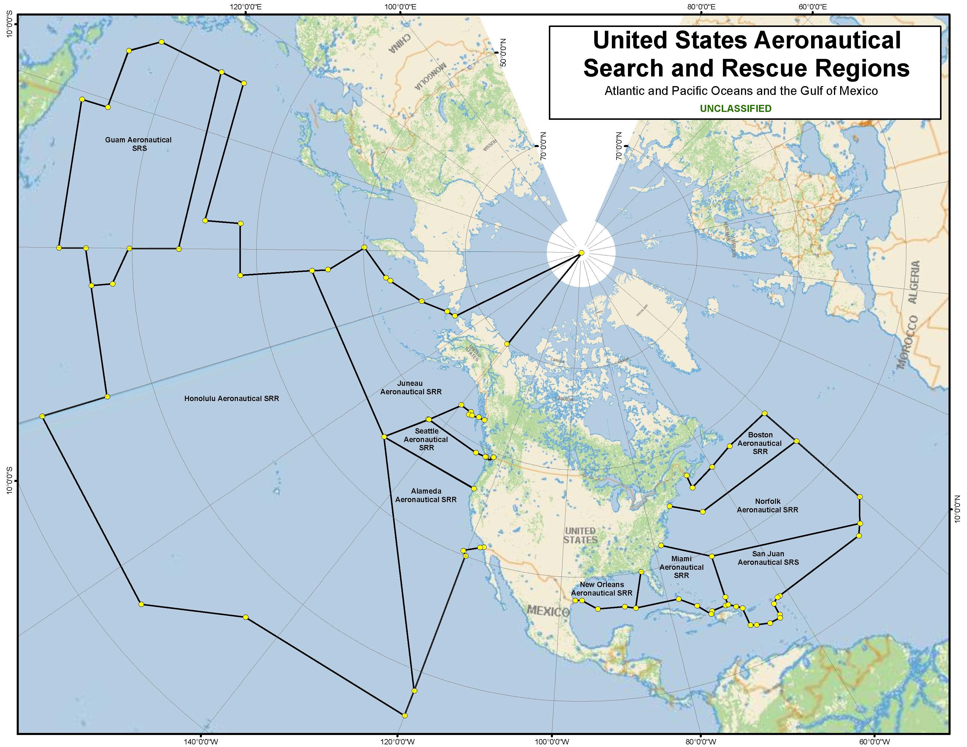
U.S. Aeronautical Search and Rescue Regions
Clicking on the image below will open a new browser window and show an enlarged 1,925 KB image.
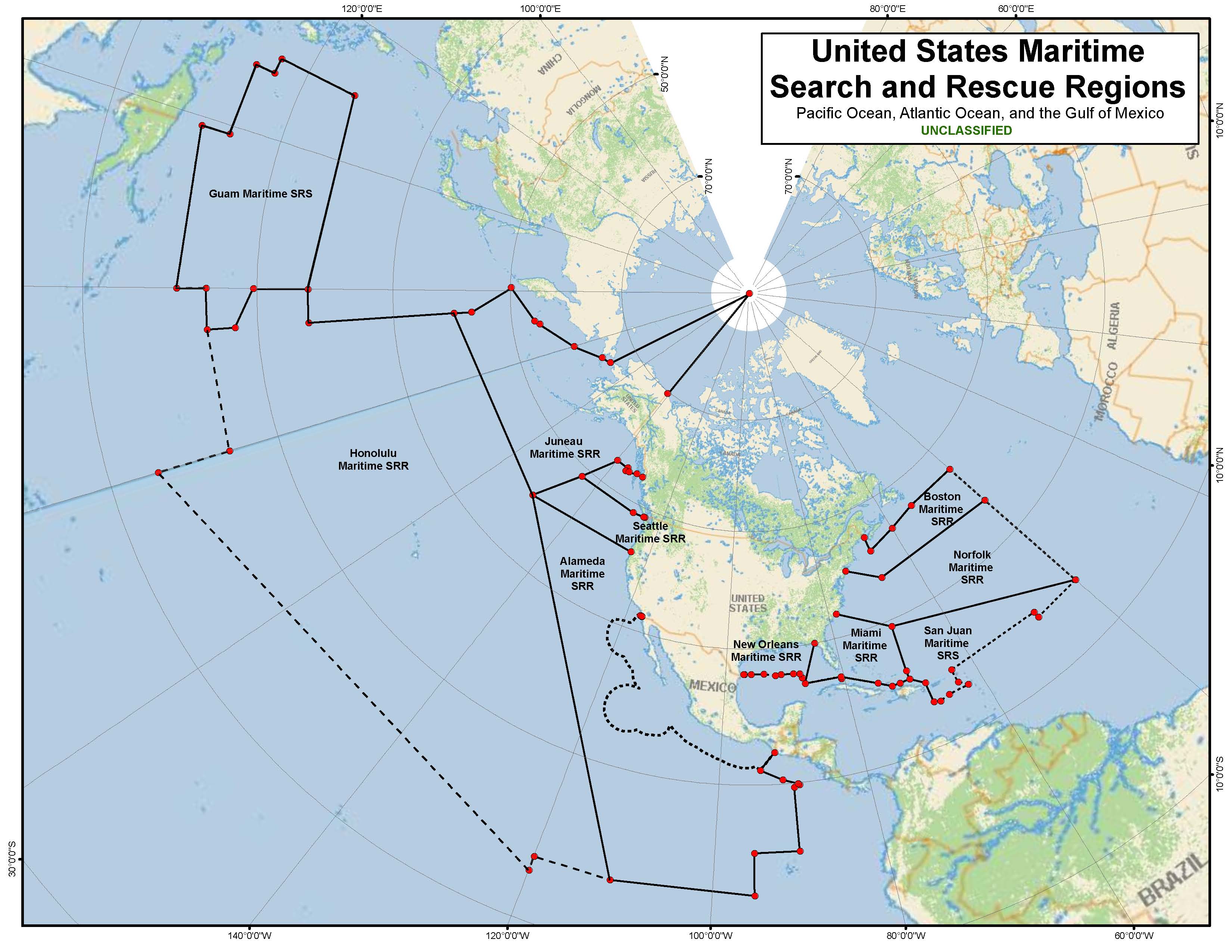
U.S. Maritime Search & Rescue Regions
Clicking on the image below will open a new browser window and show an enlarged 1,834 KB image.
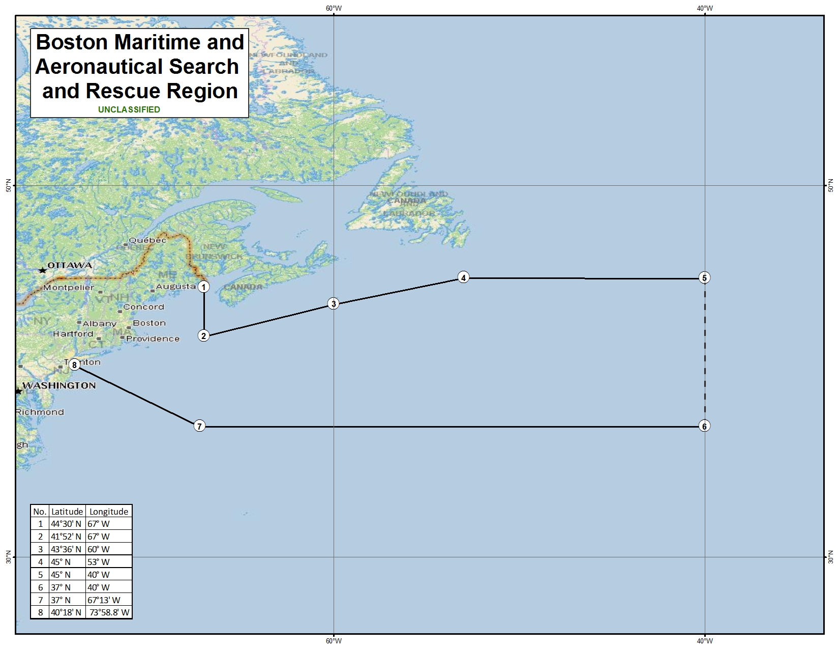
Boston Maritime and Aeronautical Search and Rescue Region
Clicking on the image below will open a new browser window and show an enlarged 602 KB image.
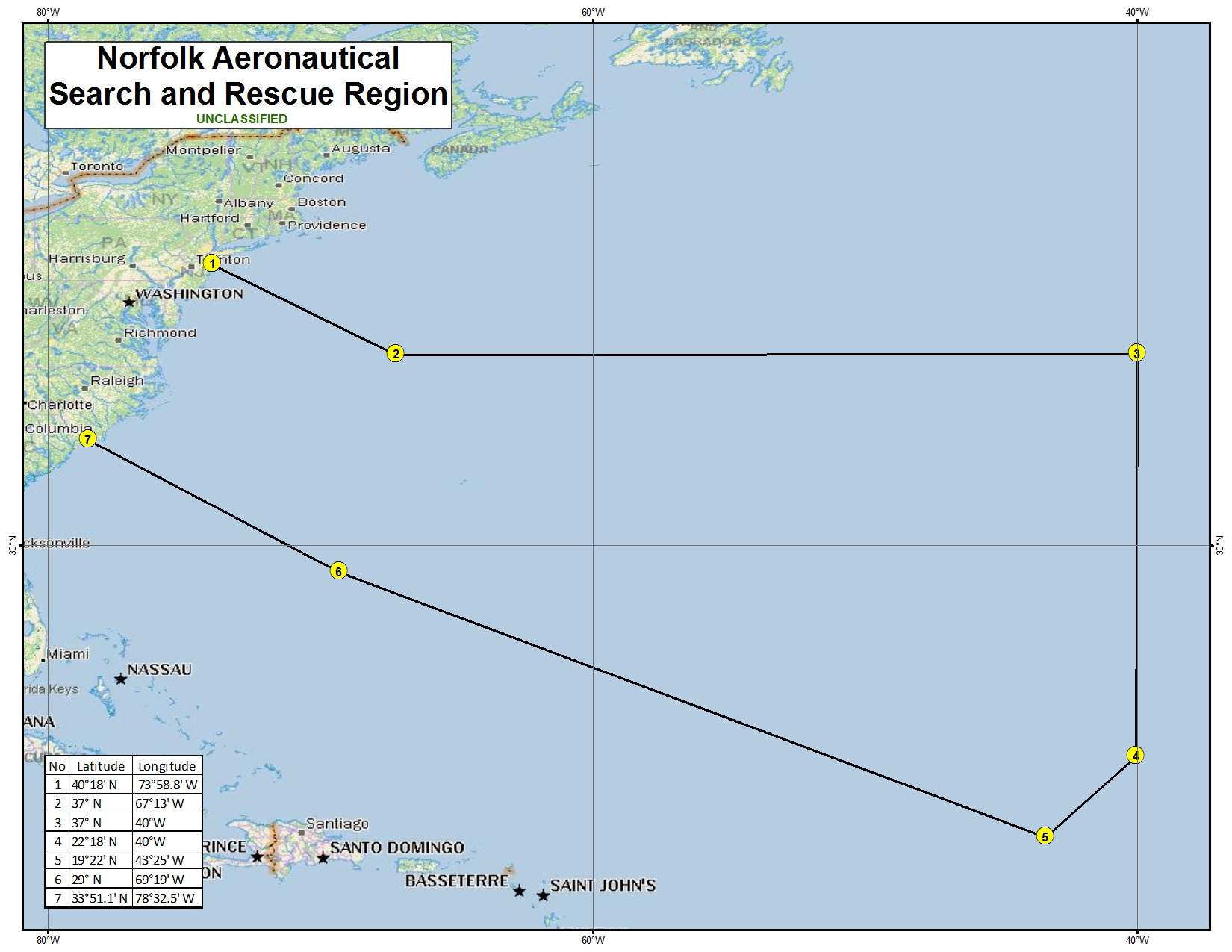
Norfolk Aeronautical Search and Rescue Region
Clicking on the image below will open a new browser window and show an enlarged 521 KB image.
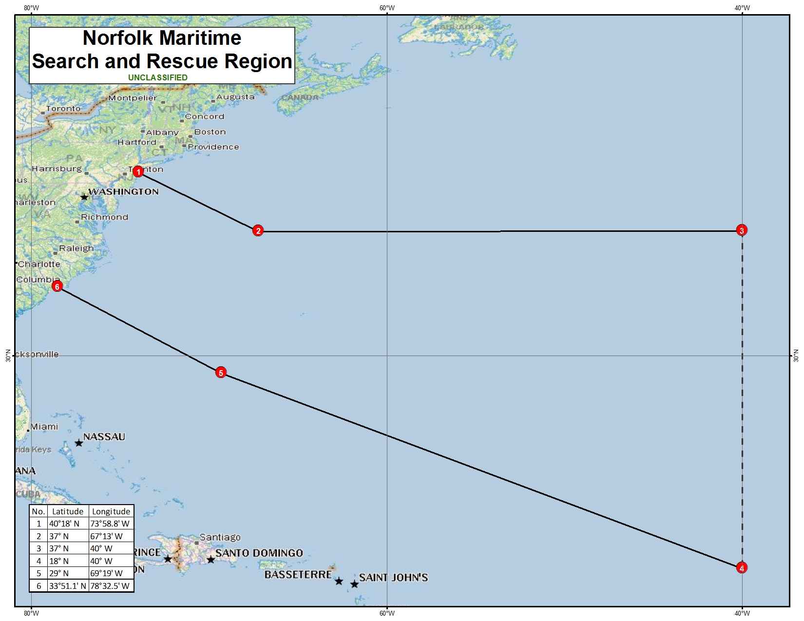
Norfolk Maritime Search and Rescue Region
Clicking on the image below will open a new browser window and show an enlarged 517 KB image.
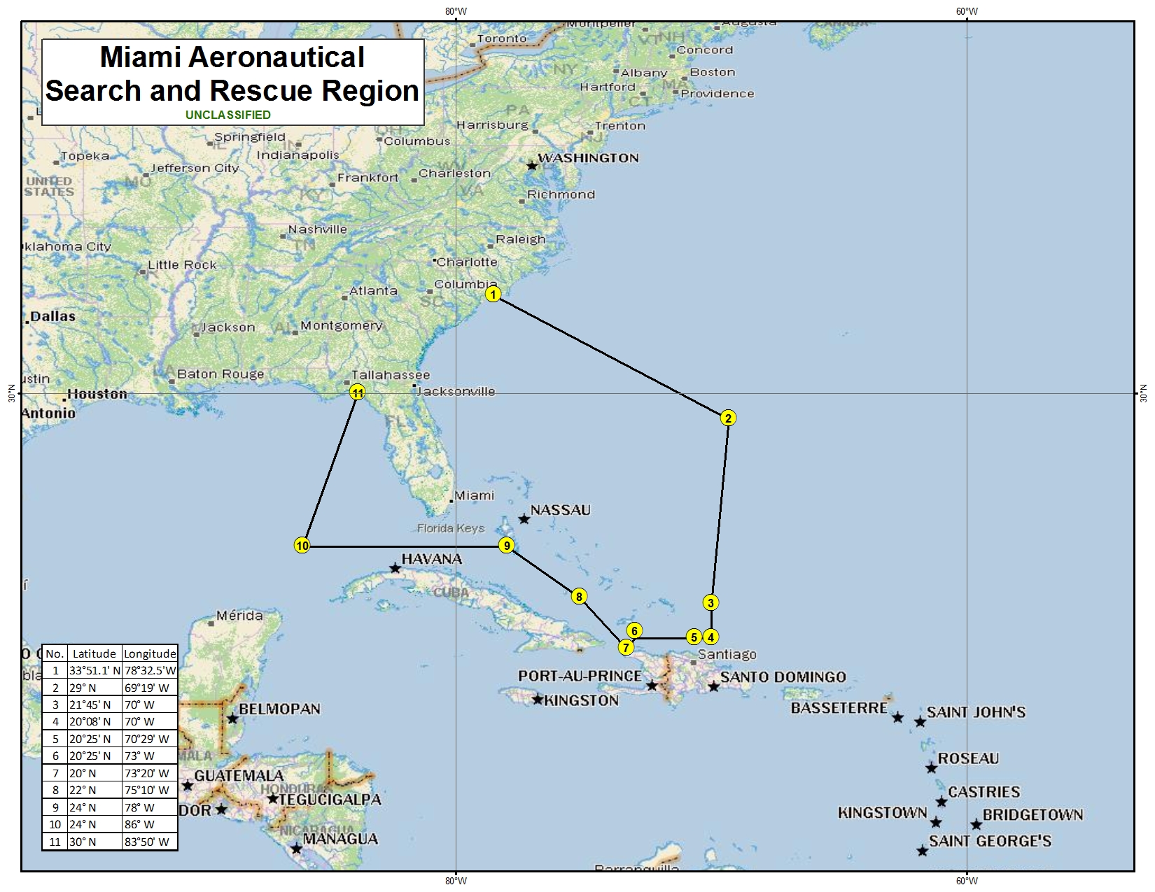
Miami Aeronautical Search and Rescue Region
Clicking on the image below will open a new browser window and show an enlarged 844 KB image.
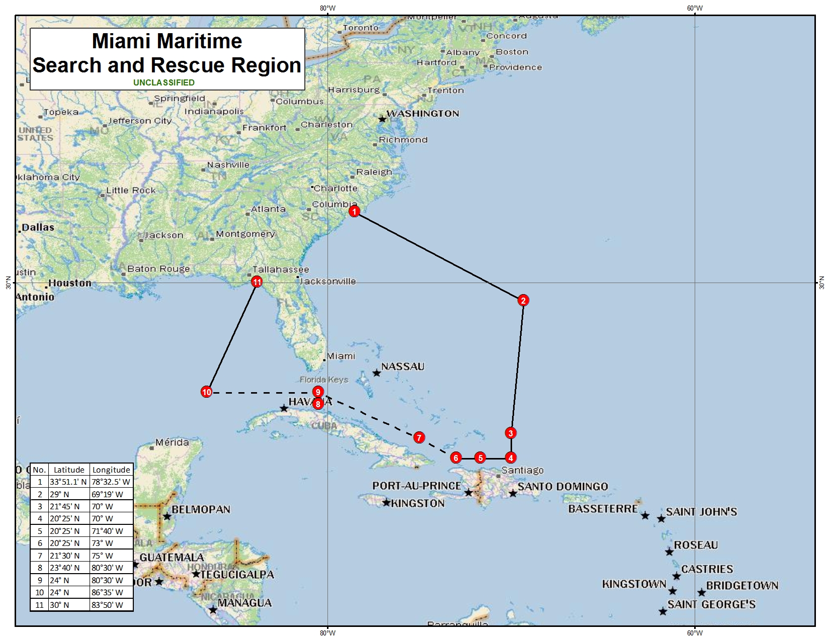
Miami Maritime Search and Rescue Region
Clicking on the image below will open a new browser window and show an enlarged 841 KB image.
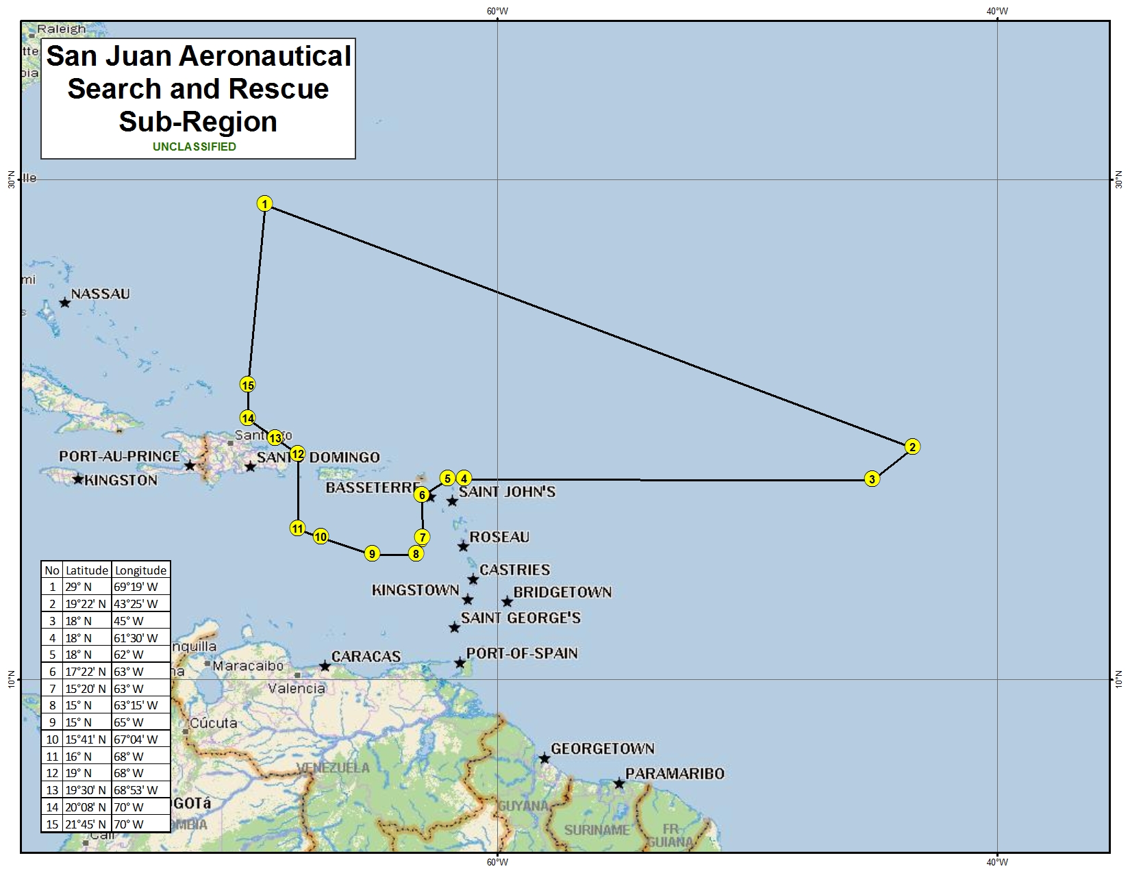
San Juan Aeronautical Search and Rescue Sub-Region
Clicking on the image below will open a new browser window and show an enlarged 578 KB image.
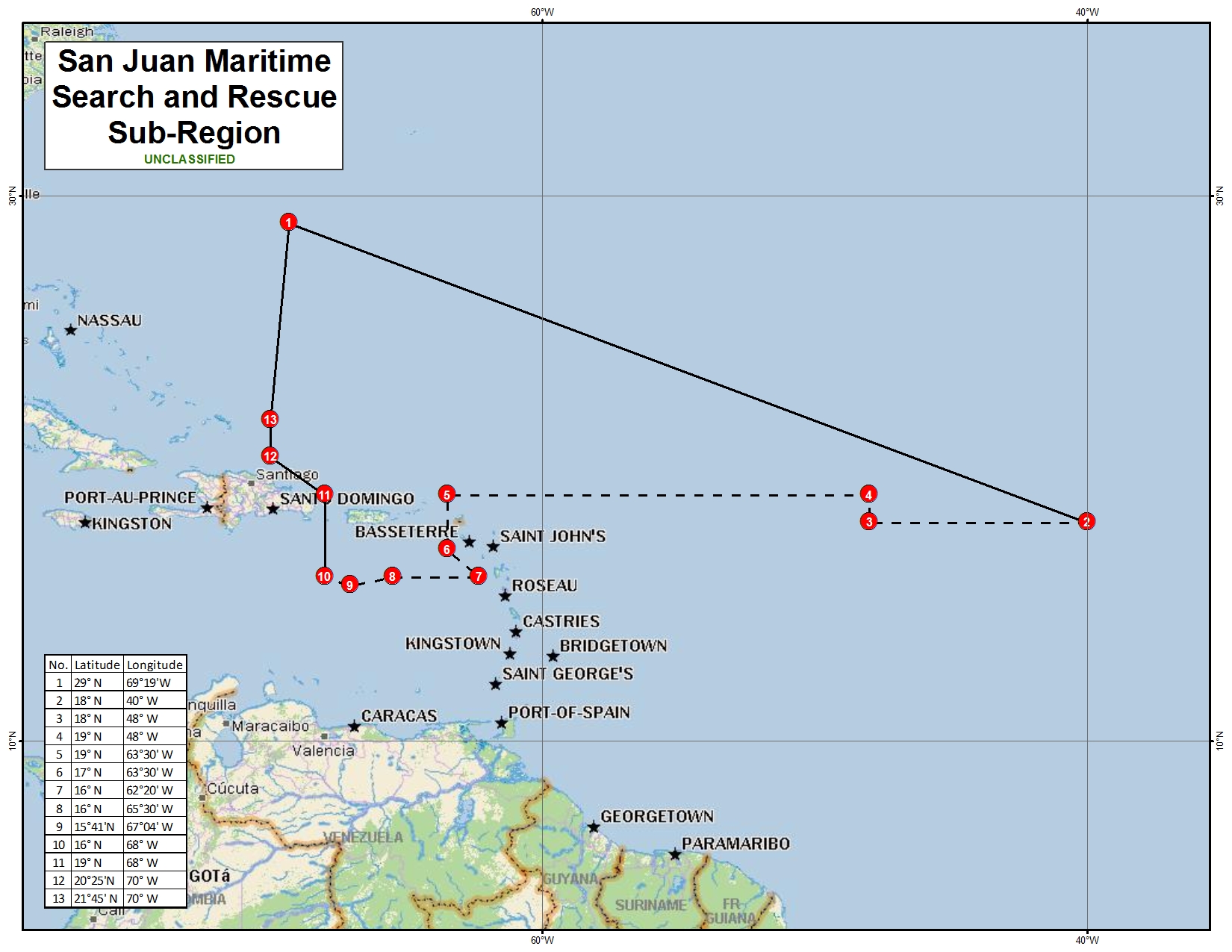
San Juan Maritime Search and Rescue Sub-Region
Clicking on the image below will open a new browser window and show an enlarged 570 KB image.
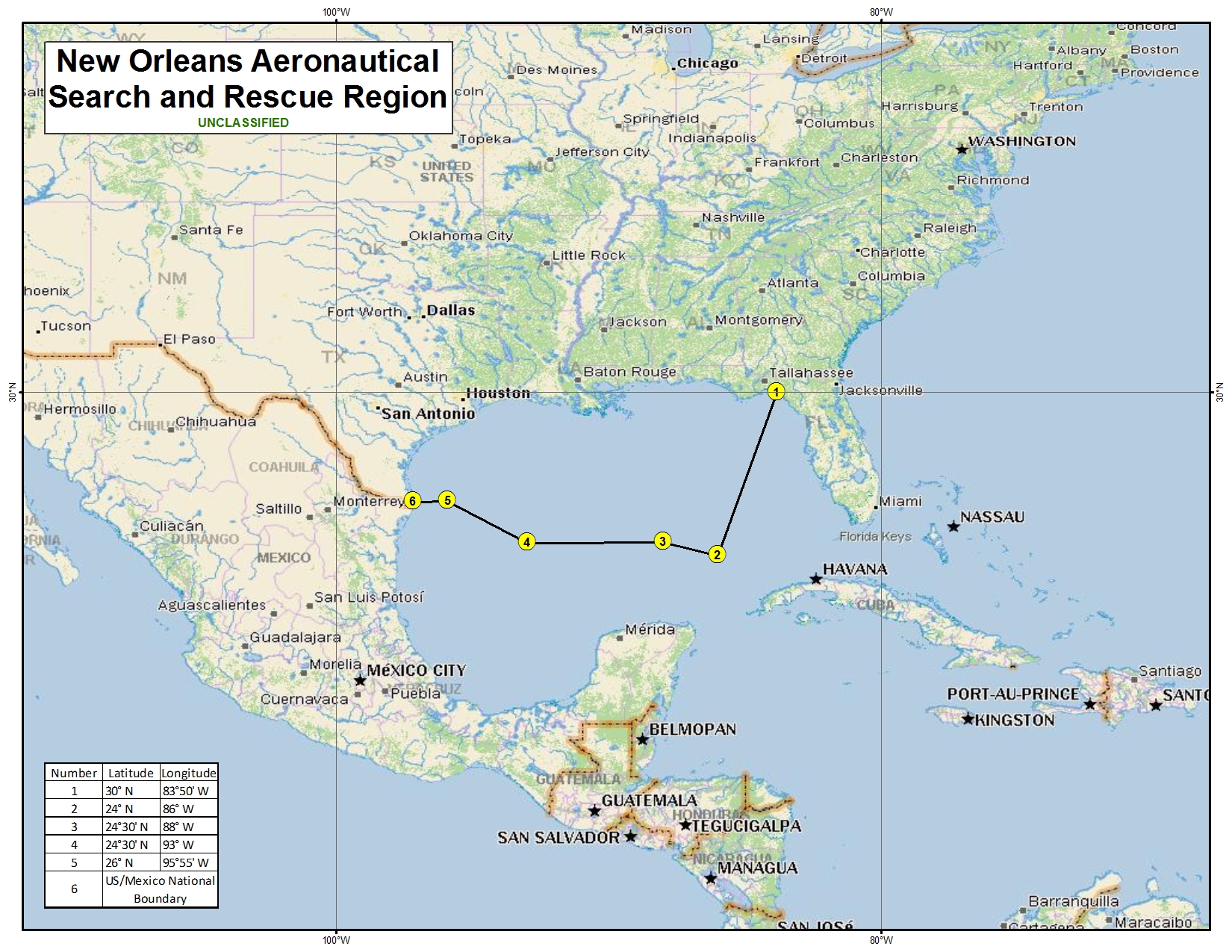
New Orleans Aeronautical Search and Rescue Region
Clicking on the image below will open a new browser window and show an enlarged 1 MB image.
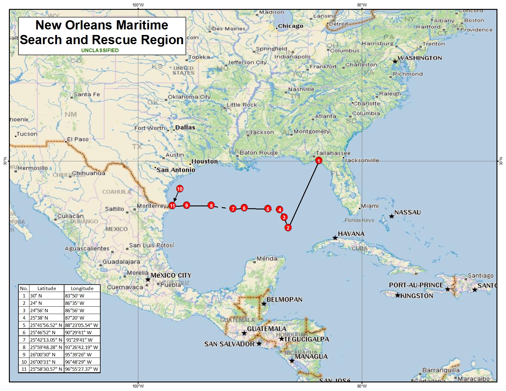
New Orleans Maritime Search and Rescue Region
Clicking on the image below will open a new browser window and show an enlarged 1 MB image.
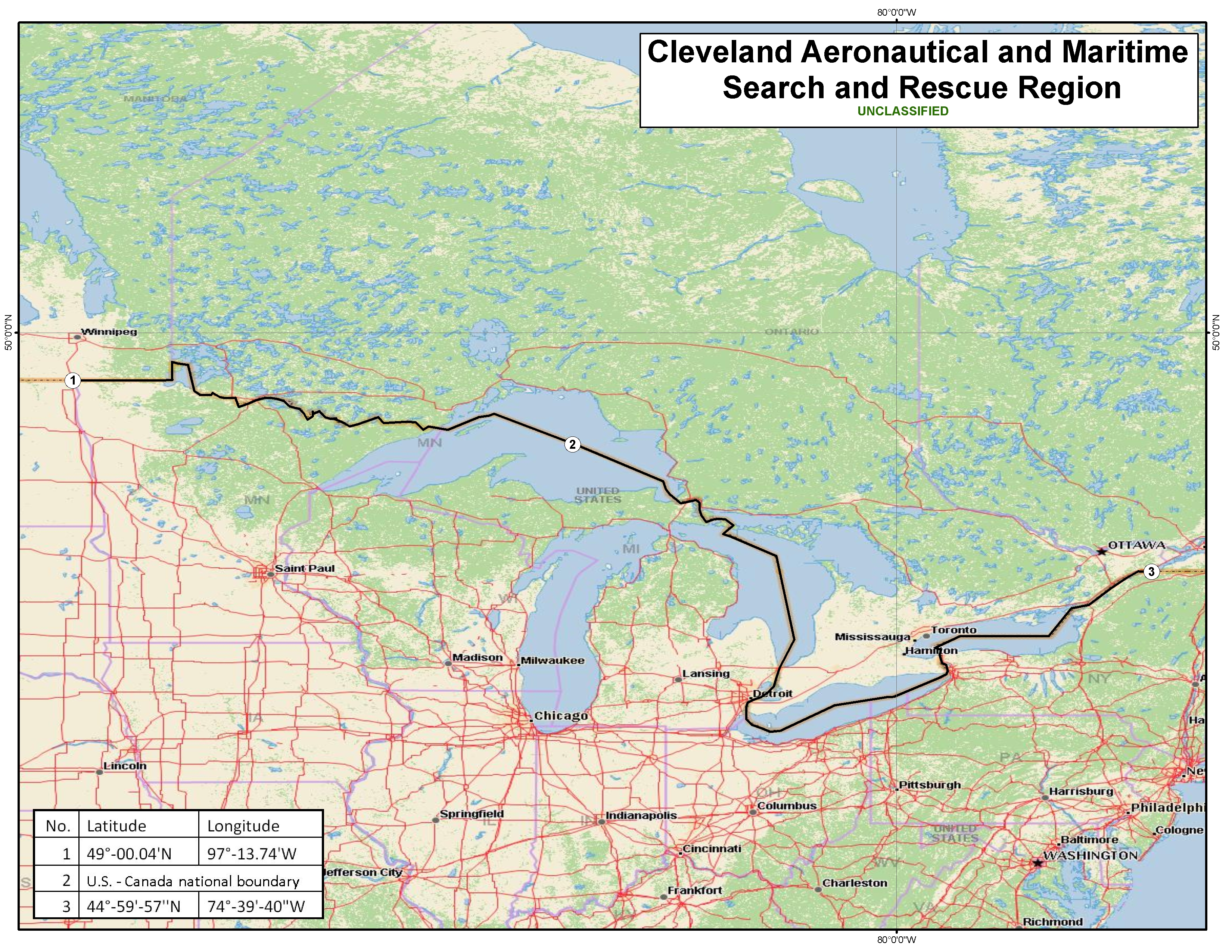
Cleveland Aeronautical and Maritime Search and Rescue Region
Clicking on the image below will open a new browser window and show an enlarged 4.13 MB image.
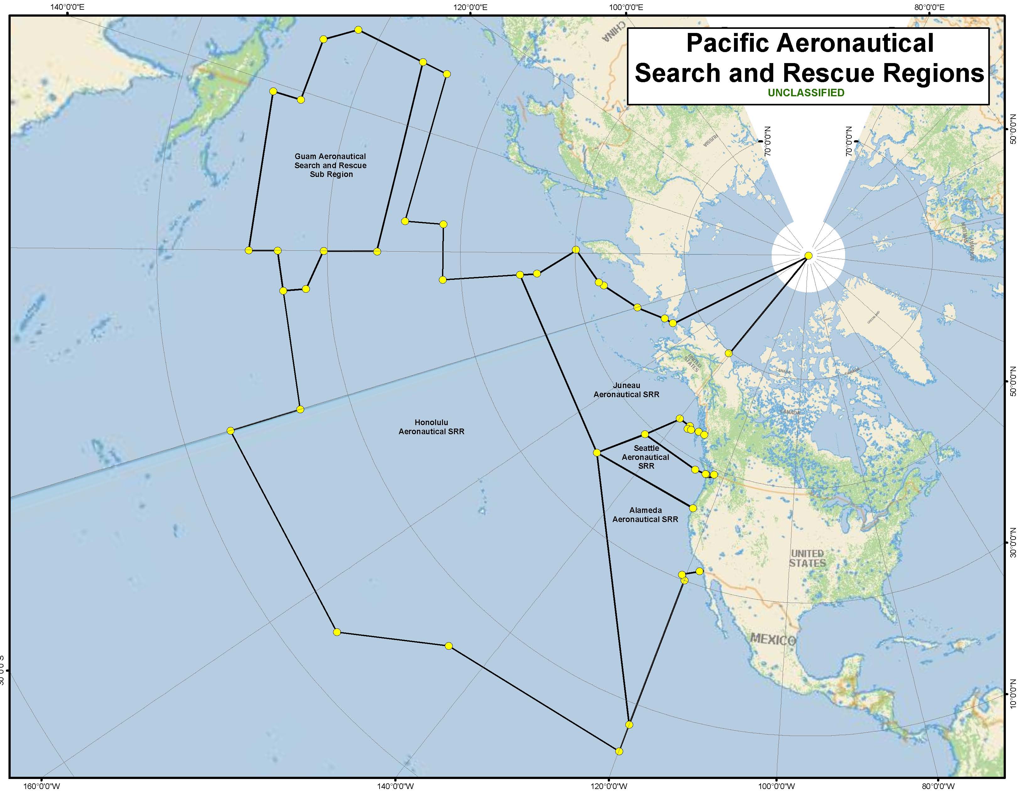
Pacific Aeronautical Search and Rescue Regions
Clicking on the image below will open a new browser window and show an enlarged 477 KB image.
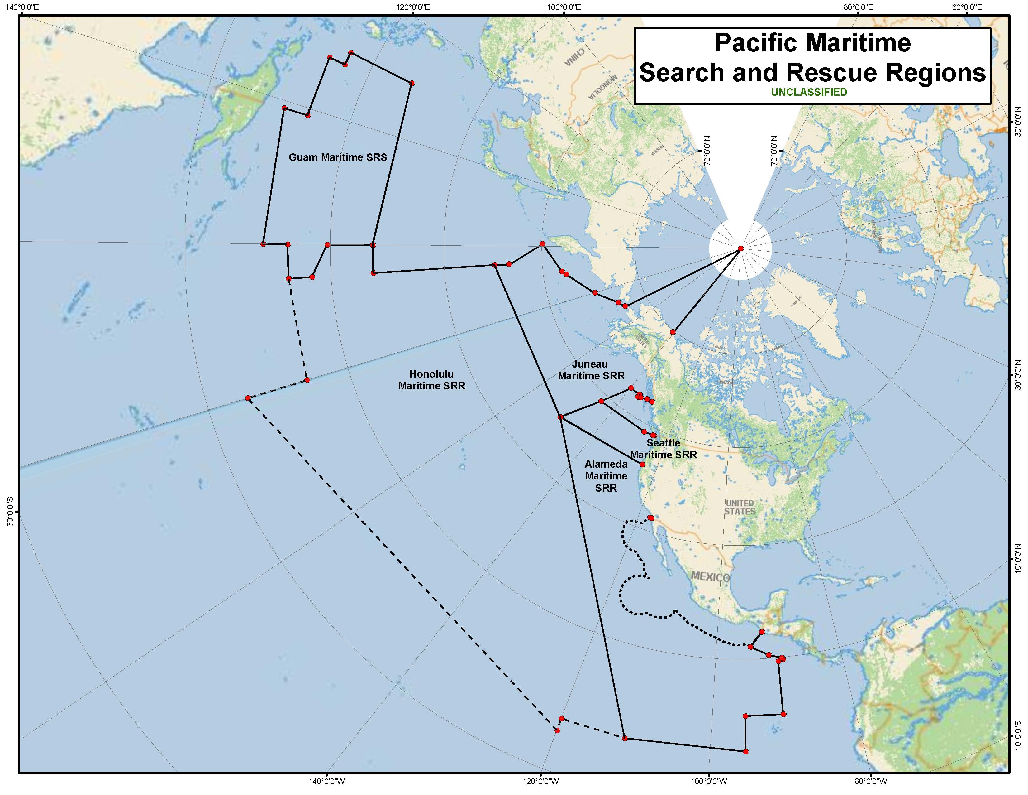
Pacific Maritime Search and Rescue Regions
Clicking on the image below will open a new browser window and show an enlarged 485 KB image.
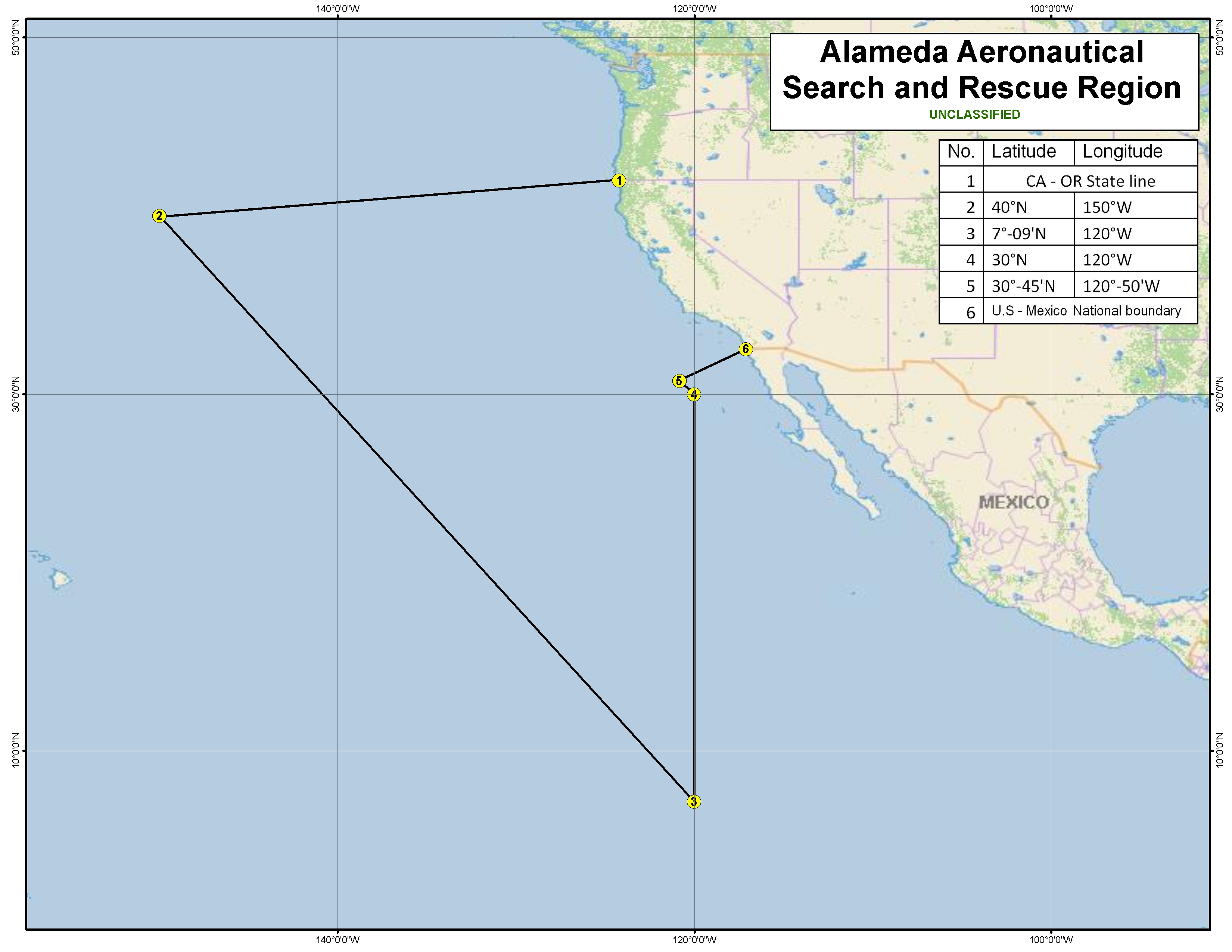
Alameda Aeronautical Search and Rescue Region
Clicking on the image below will open a new browser window and show an enlarged 916 KB image.
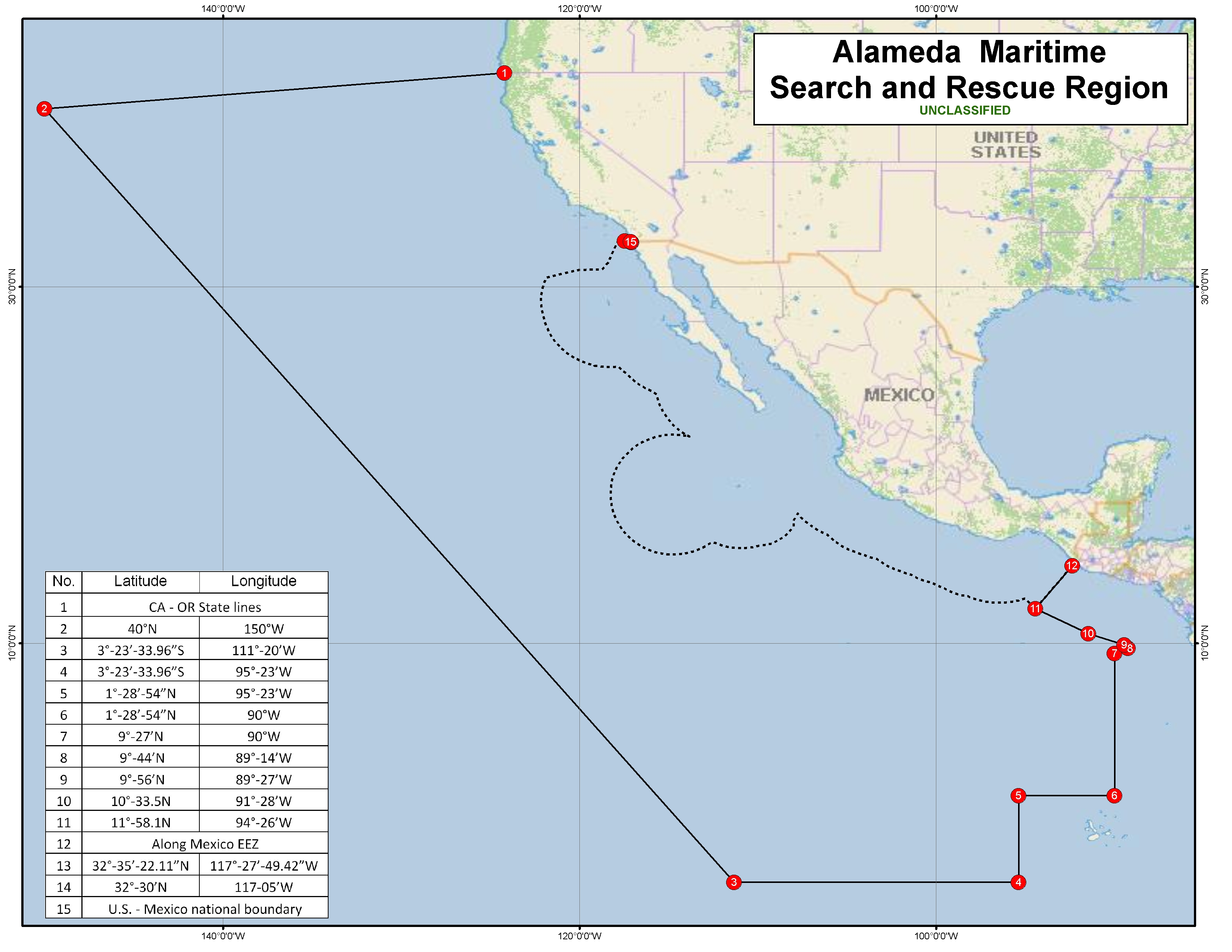
Alameda Maritime Search and Rescue Region
Clicking on the image below will open a new browser window and show an enlarged 1 MB KB image.
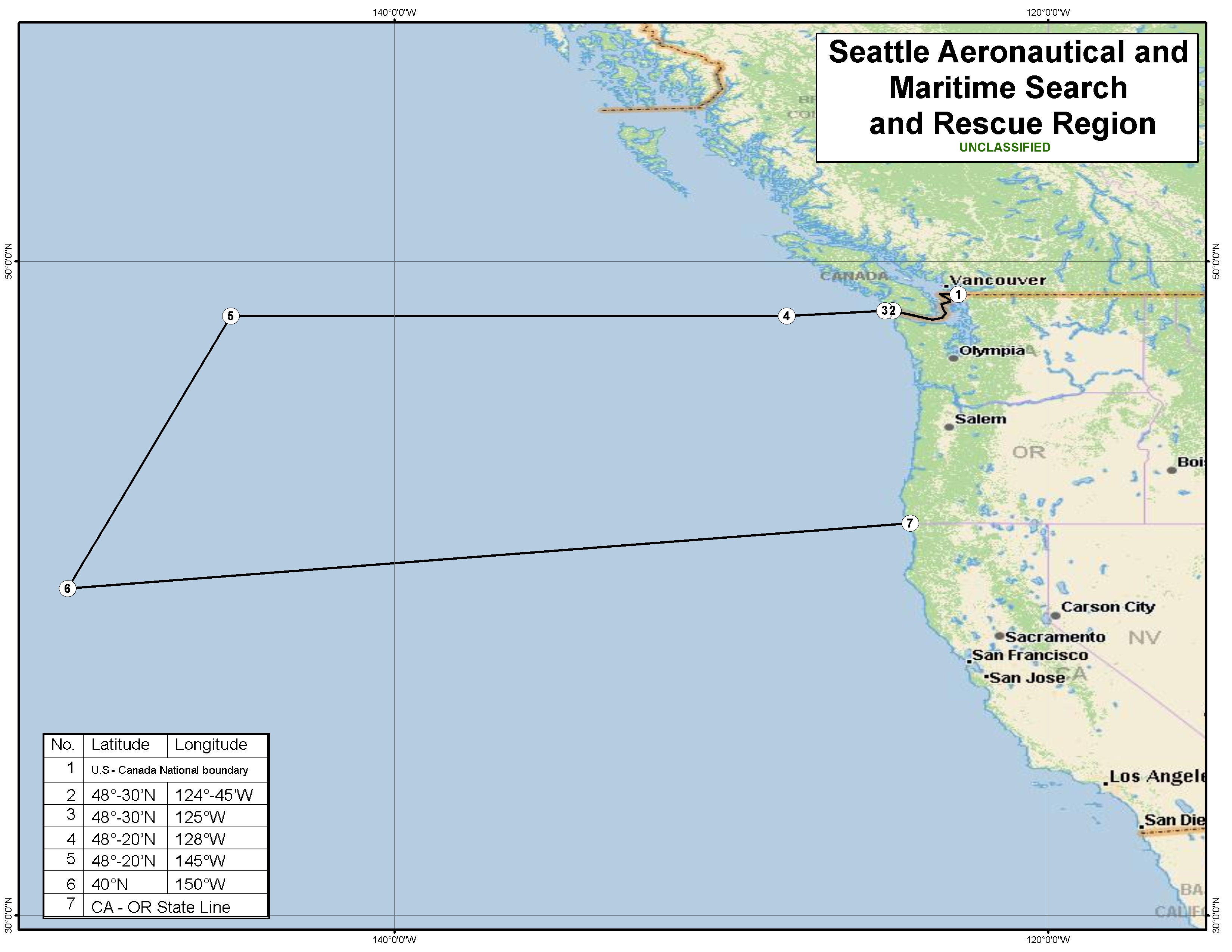
Seattle Aeronautical Search and Rescue Region
Clicking on the image below will open a new browser window and show an enlarged 1,453 KB image.
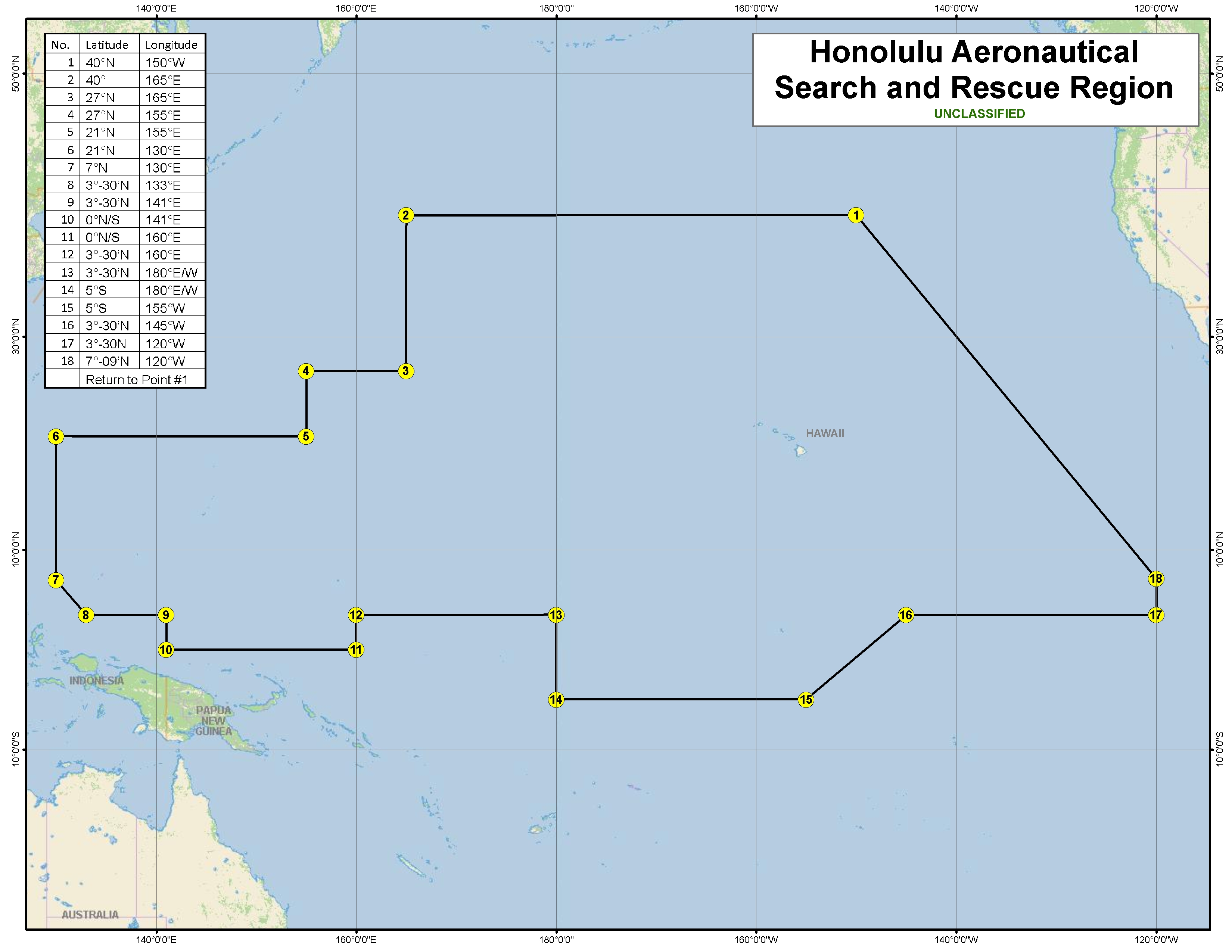
Honolulu Aeronautical Search and Rescue Region
Clicking on the image below will open a new browser window and show an enlarged 1 MB image.
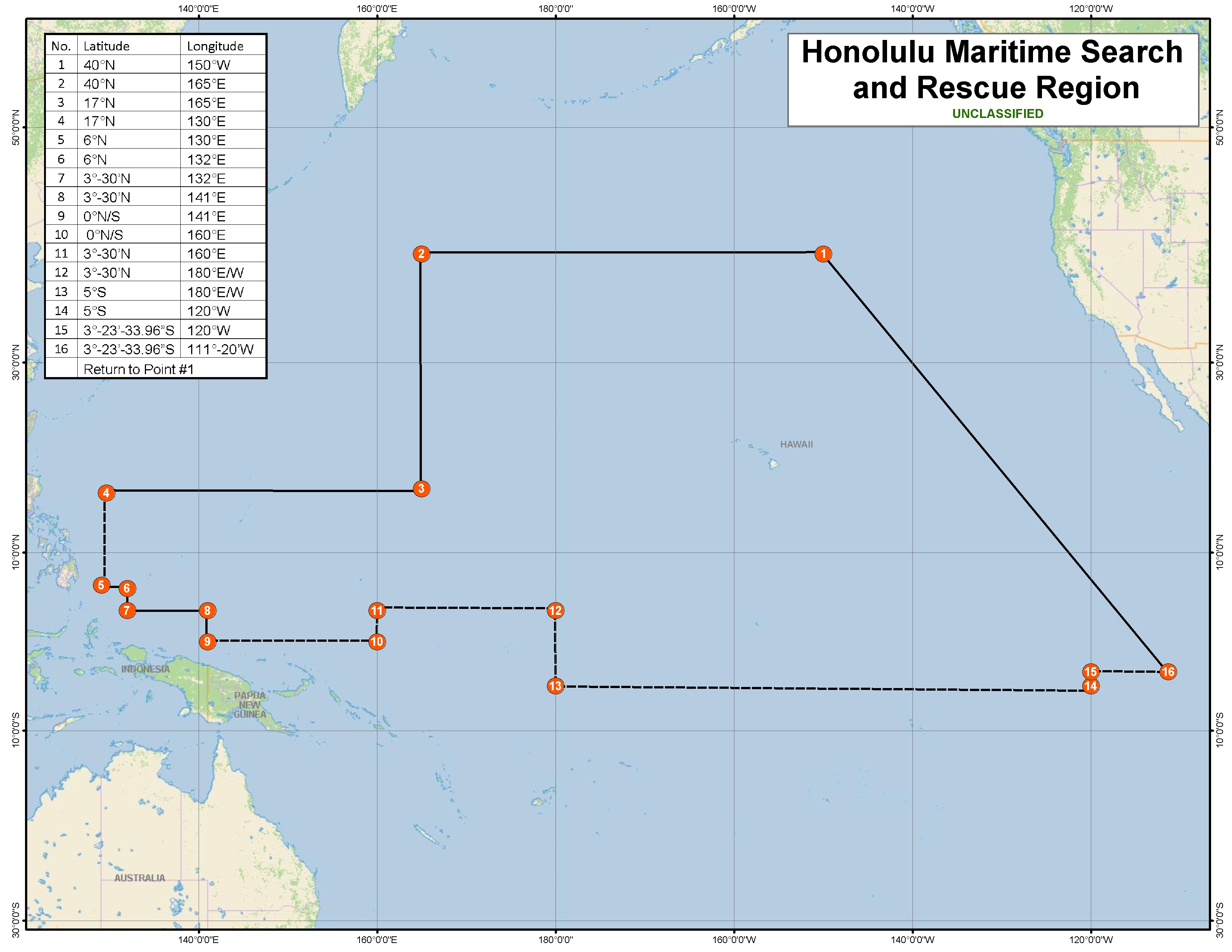
Honolulu Maritime Search and Rescue Region
Clicking on the image below will open a new browser window and show an enlarged 1.31 MB image.
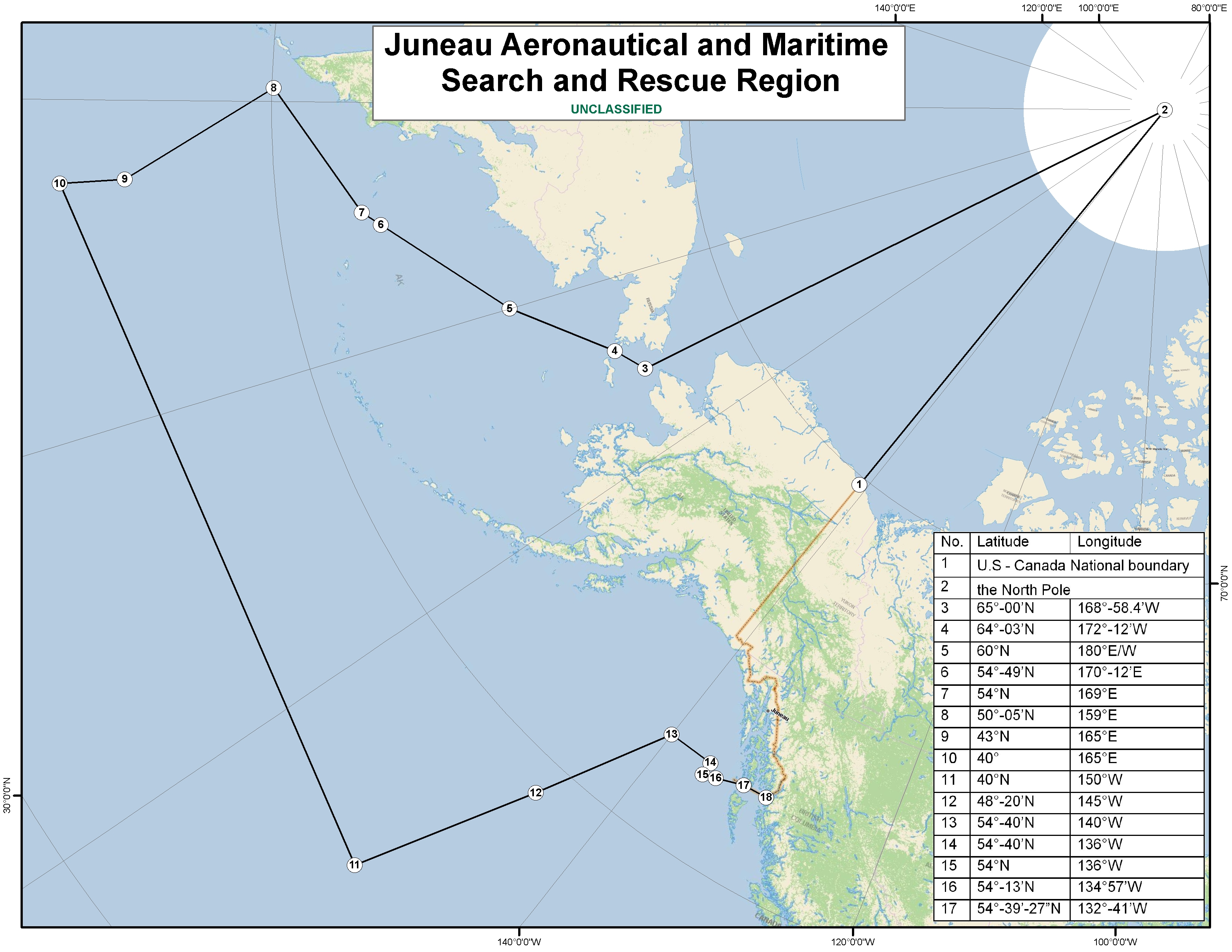
Juneau Aeronautical and Maritime Search and Rescue Region
Clicking on the image below will open a new browser window and show an enlarged 1.79 MB image.
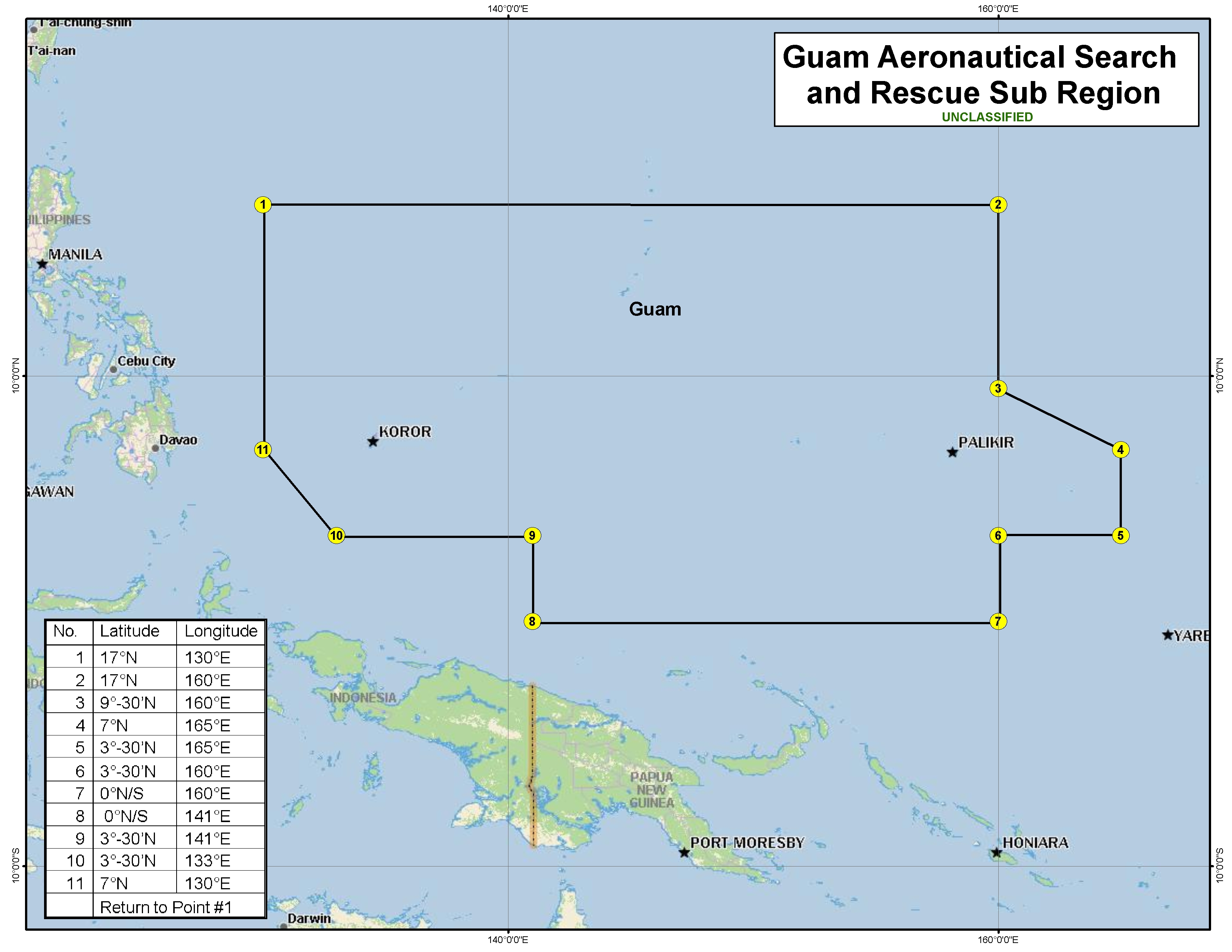
Guam Aeronautical Search and Rescue Region
Clicking on the image below will open a new browser window and show an enlarged 1.17 MB image.
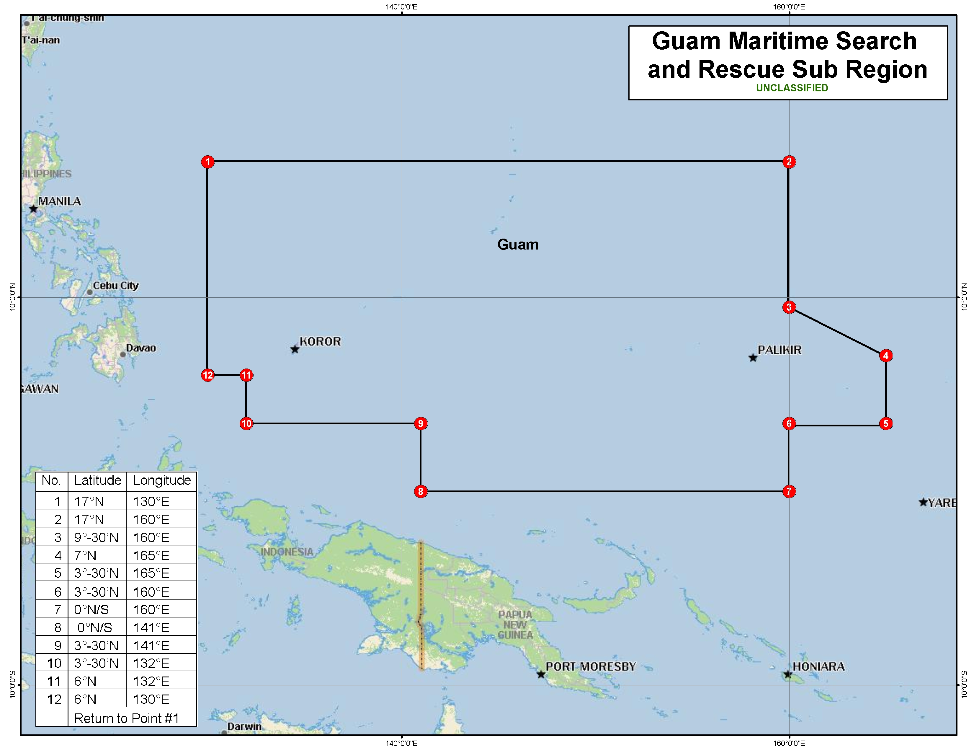
Guam Maritime Search and Rescue Region
Clicking on the image below will open a new browser window and show an enlarged 1.18 MB image.
United States Aeronautical Search and Rescue Regions
Clicking on the image below will open a new browser window and show an enlarged 553 KB image.
United States Maritime Search and Rescue Regions
Clicking on the image below will open a new browser window and show an enlarged 541 KB image.
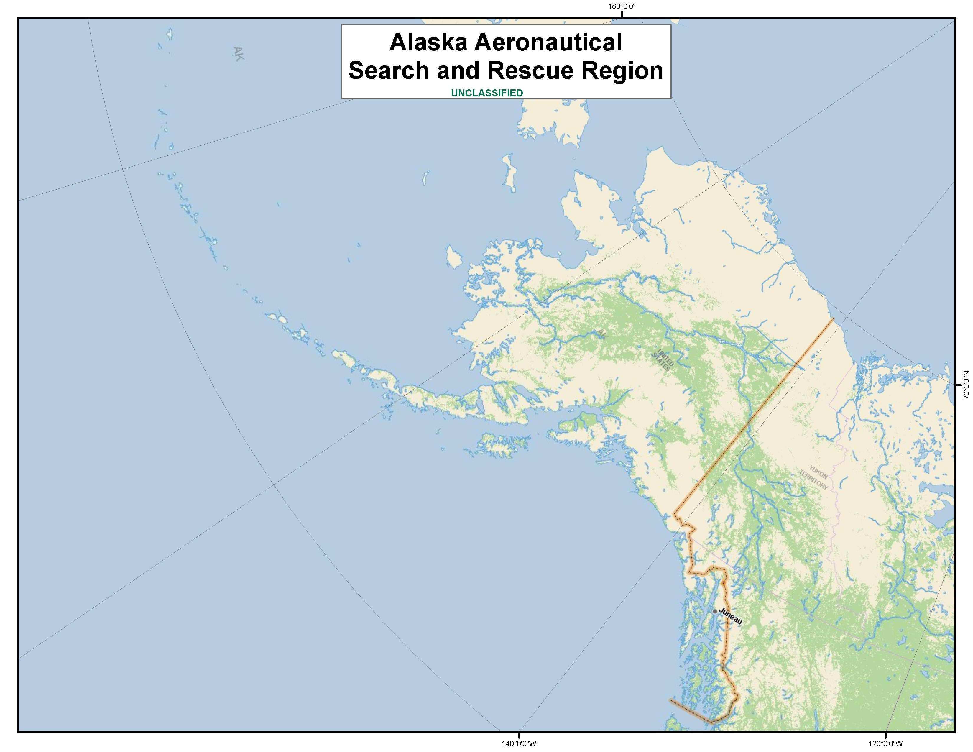
Alaska Aeronautical Search and Rescue Region
Clicking on the image below will open a new browser window and show an enlarged 1.59 MB image.
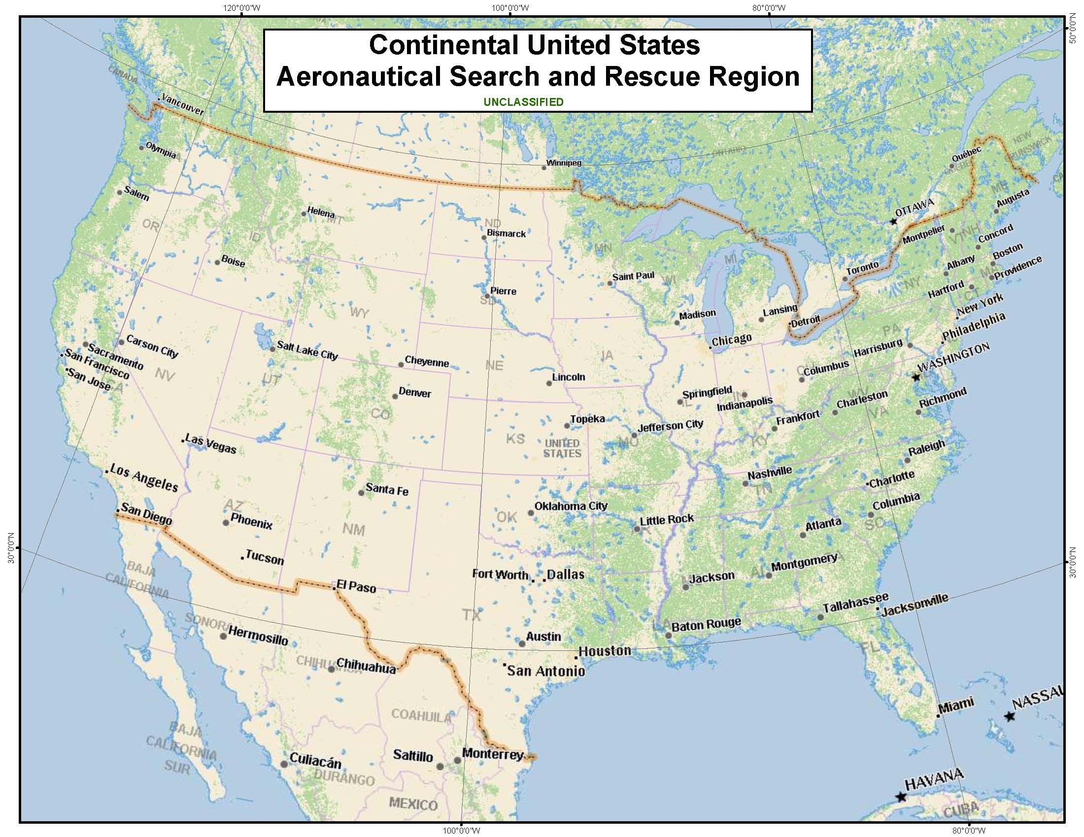
Continential United States Aeronautical Search and Rescue Region
Clicking on the image below will open a new browser window and show an enlarged 326 KB image.
***Updated Sept 2023