


")
Partnerships in SAR
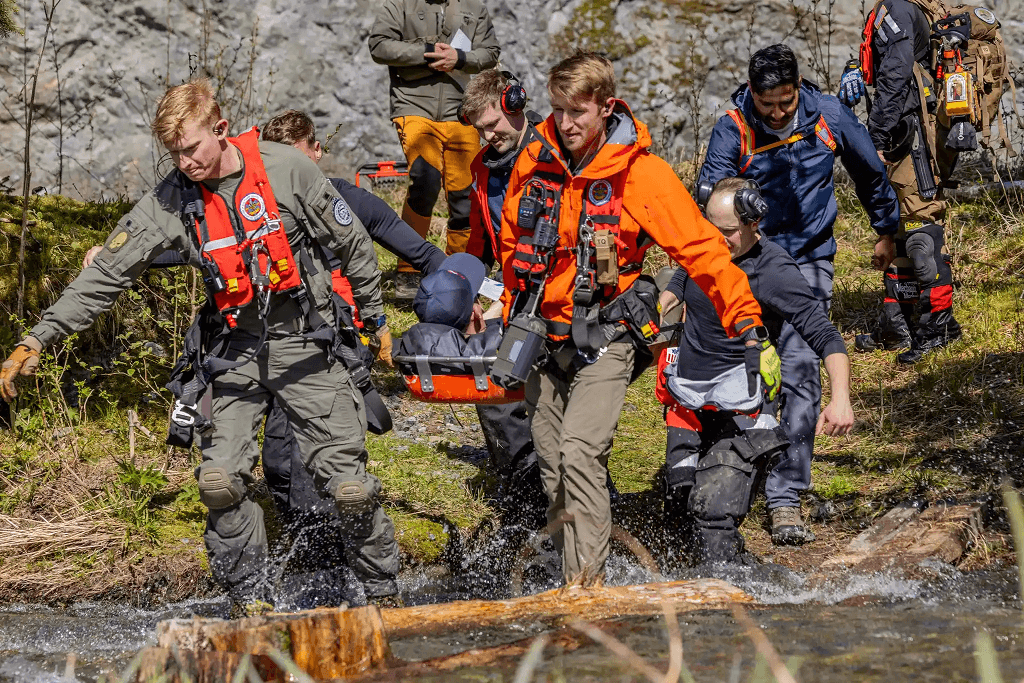
U.S. Coast Guard units and partner agencies conducted joint search and rescue (SAR) training exercises in the mountains and fjords of Alaska. Participants include the host unit, U.S. Coast Guard Air Station Sitka, the USCGC Kukui (WLB-203), 176th Wing, Alaska Air National Guard, Royal Canadian Air Force, U.S. Forest Service, Sitka Fire Dept. Search and Rescue and Juneau Mountain Rescue. (Source: USCG Facebook, May 2025)
![]()
ABOUT SARSAT
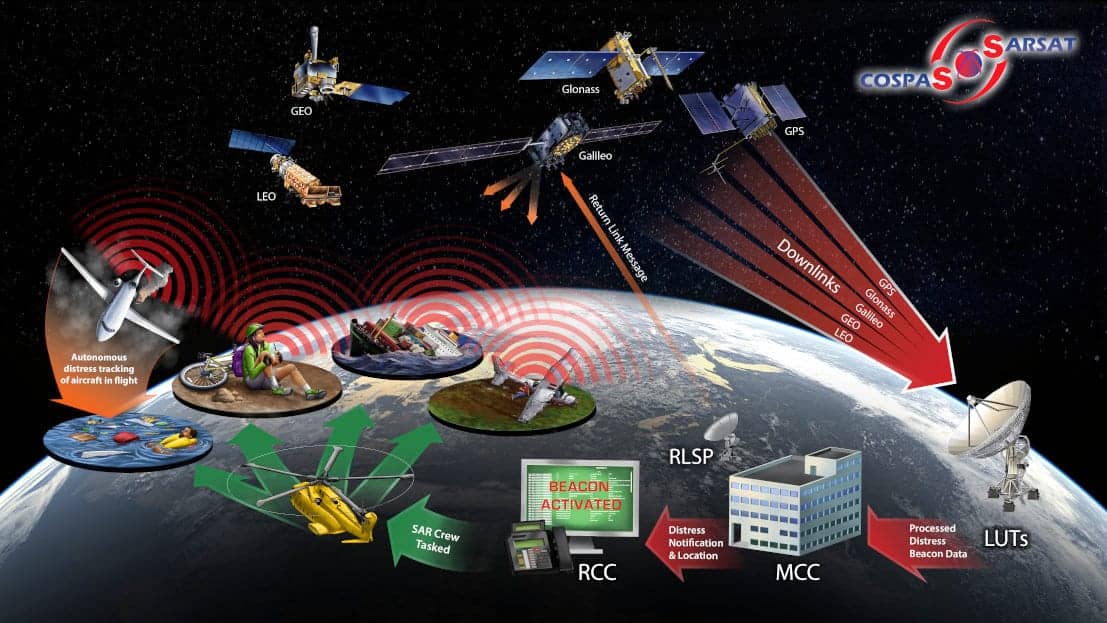
Find out how we detect and locate aviators, mariners and land-based 406 MHz beacon users in distress using space-based technology.
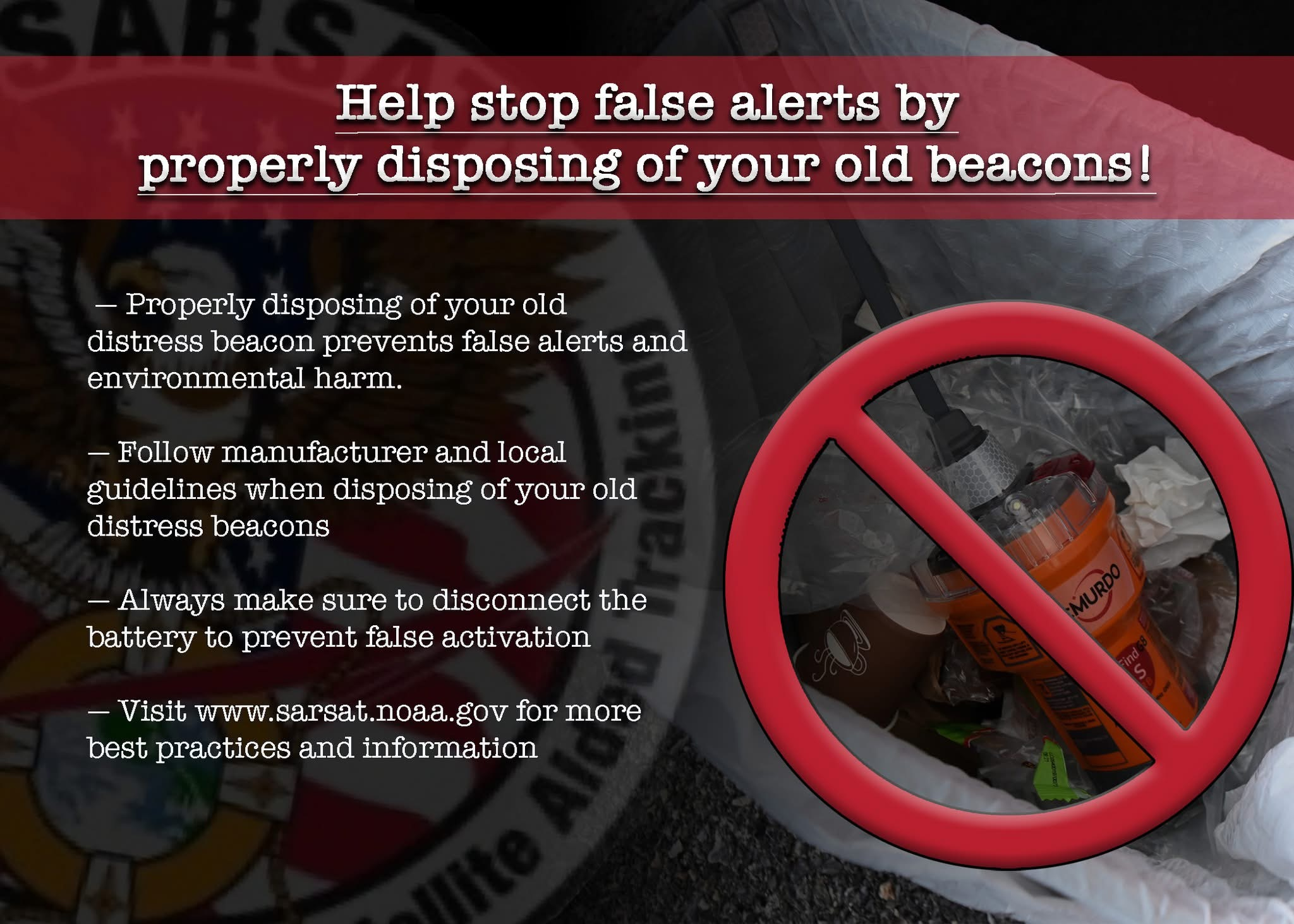
Knowing how to properly operate your 406 MHz beacon avoids costly false alerts and unnecessary SAR Crew Deployment.

Interactive Rescue Map
Explore the latest rescue operations across maritime, wilderness, and aviation domains. Click on any incident icon to access a detailed description of the rescue, including key events, response efforts, and outcomes. Stay informed about ongoing rescue activities and gain insights into the heroic work of search and rescue teams.
USCG Search and Rescue

NOAA Satellites