
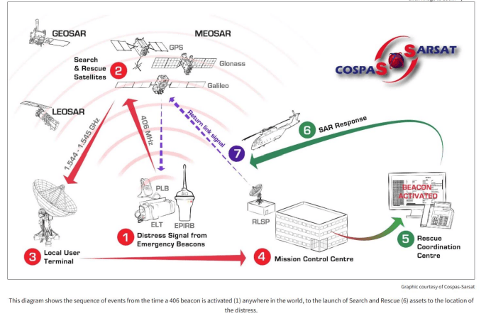
Activation of Beacon: A person or vessel in distress activates a 406 MHz beacon, which transmits a unique digital signal that is detectable by satellites in low Earth orbit.
Satellite Detection: The signal is picked up by a satellite, which identifies the signal’s location and forwards it to a ground station for further analysis.
Location Analysis: The ground station processes the signal's data, including the signal's strength, frequency, and other factors, to determine the exact location of the distress. This critical step ensures that rescue teams are deployed to the correct location.
Rescue Effort: The location information is passed to a rescue coordination center, which deploys rescue teams, such as air, sea, or land teams, to the identified area. The rescue teams are equipped with the necessary resources and expertise to respond to the distress situation effectively.
Importance of the SARSAT Program
The Cospas-Sarsat System significantly enhances the ability to locate individuals in distress, particularly in remote or oceanic environments. This distress notification capability provides worldwide coverage, ensuring that distress signals from almost anywhere on Earth can be detected. By facilitating rapid detection of distress signals, the program helps to reduce response times and improve safety of all beacon users. The service is free to all beacon owners."